Glen and The End

We had gotten into camp down on Bub Creek late the night before and were both physically and emotionally exhausted from our experience on Forester Pass. We had set up camp in the dark by headlamp. We decided to sleep in. So we didn't get going until about 11:15. We had the same plan as yesterday. Get to Glen Pass and if the weather looked bad, we would wait to cross it the next morning. While staking out the tent the night before I had felt my back twinge and it was hurting in the morning. I took some Ibuprofen but that is a diuretic and we'd need to pump more water so I wouldn't get dehydrated. Pumping water was not a fun chore anymore for either of us. But the Ibuprofen worked.

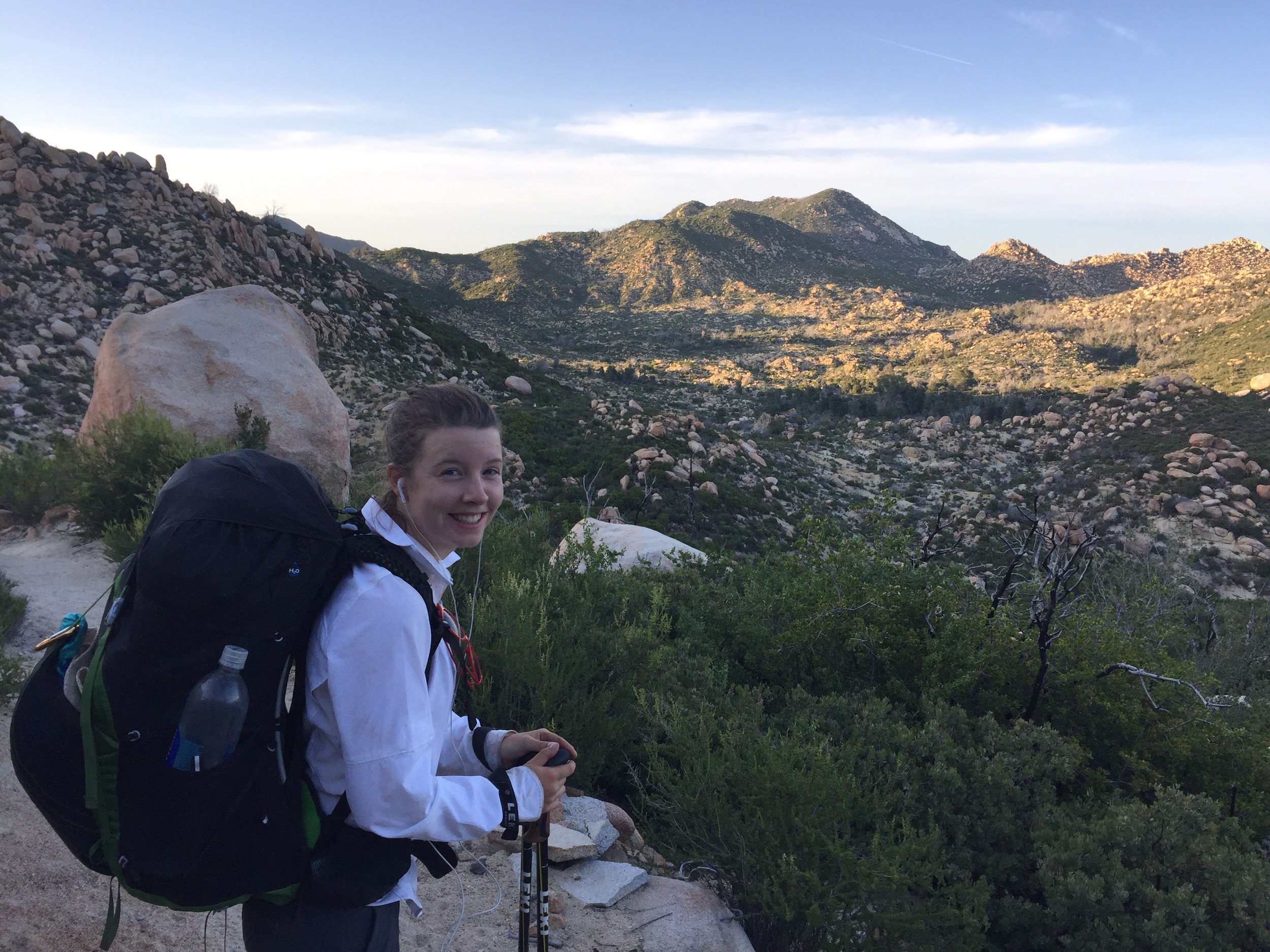
It was a long descent and another steep ascent to even get to the approach to Glen Pass. Such classic U-shaped glacial valleys. Beautiful but when you are climbing up the steep part of the U, there's some work involved. The sleep-in definitely was great. As we came closer to Glen Pass I started getting nervous again. I didn't slip into a panic attack though. This time I followed right on Maddie's heels and just focused on her shoes. That definitely helped. But I sacrificed the beautiful views going up and I miss those. Somehow we had both lost our lip balm and her lips were getting pretty cracked and chapped. She took this photo on the way up Glen Pass. She says it's her "climbing face" and her lips are too chapped to smile. You can see me in the background just focusing on the ground and not looking down.

Maddie's "climbing face".

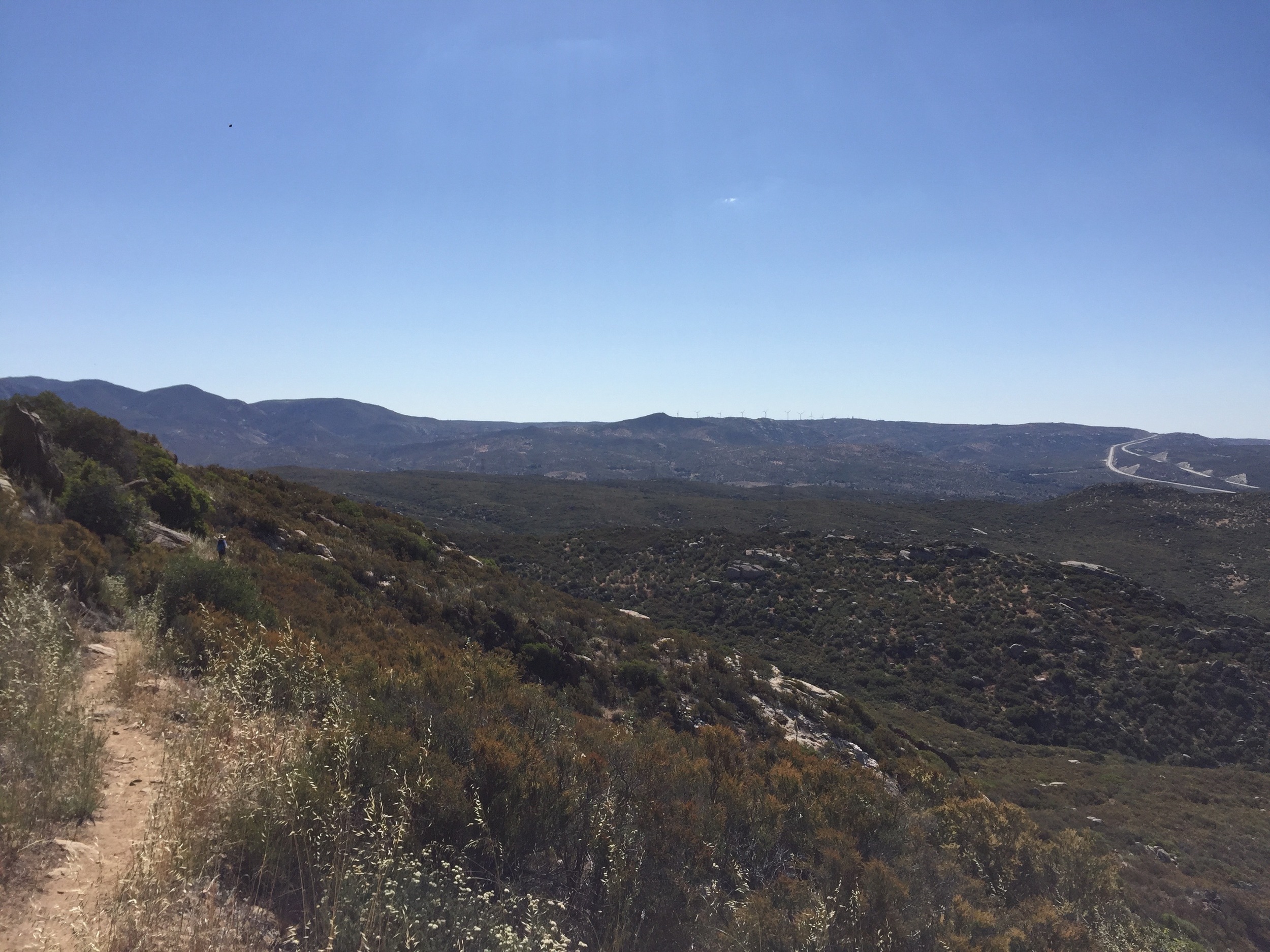
Glen wasn't as exposed as Forester. Still, it was an effort to focus and not let my imagination run away and I was relieved to make it to the top. Somehow it's always easier going down. Maybe it's because the North faces of these passes are less steep than the south. We met some other PCT hikers lounging at the top. We are all pretty far back from the regular PCT pack by now. This group (Ballou, Happy Meal, Stitch, and Rembrandt) are from Corvallis Oregon and have purposely decided to go slow through this section.

Top of Glen Pass


Maddie and I talked about going slower, but hadn't done it. We really only had enough food to make it in the planned 9 days. We needed to do a pass a day. It's was very tiring though. The physical effort is not overwhelming, but it is relentless. Now I also have this psychological shit to deal with when crossing passes. I'd heard Benson pass is the scariest, steepest, and most exposed. I was already getting nervous about that. I stopped to ask a ranger and a few other folks if Pinchot Pass is very exposed. I don't know and not knowing is what was scaring me. But either folks didn't know, or they didn't know what I was asking about and I could get no real info. 

There are quite a few more hikers on this section. Not just JMT hikers (John Muir Trail) but we are also seeing quite a few doing the Rae Lakes loop. Admittedly the Rae Lakes are amazing and we camp that night at Middle Rae Lake.

Upper Rae Lake

That night we meet a group from Ohio State University. There were 14 of them and they were out in the Sequoia/Kings for quite a long time, I forget how long, but weeks. They were being resupplied by pack train. It made me feel nostalgic for when I was an outdoor guide and instructor in the University of Nebraska - Lincoln outdoor program. So, I had to visit with them for a while and swap stories. I told them I met my wife 30 years ago on a University Grand Canyon hike and asked them if there were any budding romances on their trip? They laughed nervously and said nothing. So, I would guess the answer was yes. Lots of romances and weddings came out of our UNL trips. Some of our best friends we met or worked with on those trips. So, it was a very nostalgic meeting for me.

Another day, another pass. We were tired and not sure we could make it over Pinchot pass and to a decent camp that day. Typically the day starts descending, then you meet a connecting U-shapped valley. Typically a hanging valley so you have to climb up the U of your valley to get into the connecting valley. We knew we'd be at Wood Creek about lunchtime so we put off any decisions until we got there. I was popping ibuprofen again and my back was hurting. So far, not getting any better.

At Wood Creek we had lunch and decided my back wouldn't get better if I had to keep carrying the pack and not resting it. We also talked about both of us having lost our enthusiasm and the daily grind was getting to us. We knew by now we wouldn't complete the trail this season. We talked about cherry picking a few sections and/or doing some hiking with Mrs. Weasley and Kona. It was sad realizing we weren't going to make it. We talked to a few hikers who were doing the Rae Lakes Loop and it was clear we could walk out from here to the west and take a few more days off to let my back rest up. Once we realized that was an option the temptation to take that option became overwhelming for me, and I think for Maddie as well. We hadn't been eating very much. All PCT hikers are hungry all the time but we weren't even eating our meager rations. A bit of altitude, a bit of exertion, a lot of revulsion toward our cold re-hydrated food, and we never really ate our full rations for the day. Ironically, slowing down would have made us feel better and eat better. But we didn't have enough food to slow down and take shorter days. We'd run out of food before hitting VVR. I guess that was not the best planning. Originally I had hoped it would keep us closer on track to finish. But, our hypothetical daily distance to finish was 22 miles a day. Our longest day was 21 miles and we were super tired at the end. The only thing we looked forward to on long days was not food, but bed. 

So, exiting and resting up, and eating real food, sounded so good that it became an irresistible option. And to be honest it gave me a sense of relief that I didn't have to face another pass that day. All we had to do was go 14 miles, down Woods Creek, down Paradise Valley to the trailhead. Hitch a ride to Fresno. Eat food. Sleep in a bed. Ahhh. So, we decided to exit - stage left. It was about mid-day and first we had to cross the suspension bridge over Woods Creek. Looked super strong and stable. But, when we were going across we noticed the bolts that were missing or half-way unscrewed, the cross-boards that were cracked, split, or missing, and the overall condition of the bridge seemed a bit sketchy.

Since it was mid-day, and we wanted a ride when we got to the trailhead, we decided not to do the 14 miles all the way out. We could have. But, we would have gotten in at night and the likelihood of a ride was minimal. So we camped that night at Middle Paradise Valley campground and provided a feast for the Mosquitoes also camping out there. We had some mosquitoes at camp for awhile, but this was truly crazy. I pumped water and getting to the river I stirred up several hundred who buzzed my head-net the whole time I filled up our water. Maddie washed off her DEET before bed and was consumed while she made it back to the tent.

The next day we continued, down the south fork of the Kings River, and met Trief and Harry. We told them we were heading out for a few days and they offered us a ride which we gladly accepted. It turns out they were going to San Jose and could give us a ride to Gilroy, where Mrs. Weasley was staying. We though that sounded better than a couple of nights in a Fresno hotel so we decided to go to Gilroy. Susan (Mrs. Weasley) was delighted she didn't have to drive to get us. She had been tracking our SPOT and noticed when we veered off of the PCT.

Paradise Valley.

South Fork Kings River.

We came out and Trief and Harry graciously gave us a ride to Gilroy. Thanks guys!

Thanks to fellow hikers Trief and Harry for the ride!


So, then off to Gilroy. Originally we had planned only a few nights to rest my back. But, we had grown tired of how relentless the trail was. We knew we weren't going to finish the trail this season. Maddie thought any of our "consolation" hikes would just waste time for her when she needed to be looking for a job. I was relieved not to have to worry about crossing "death-defying" passes. I wanted to work on Wanderfeast and if I couldn't make enough progress on that, look for a job as well. Neither of us wanted to keep going on our own. We lost momentum day by day as we continued to debate what to do. Soon it became clear that we felt done with the PCT, that neither of us wanted to continue. We went to visit another friend close by. Where we decided that our adventure was truly over and that we should just head to Florida so we could retrieve Maddie's car from storage and move her things back to the Northwest. Sigh. Our adventure was coming to an abrupt and unforeseen end. I'd heard and read how psychological the PCT was. It was different reading about it and experiencing it first hand. 

So, back to the self-loathing I referred to in an earlier post. That's an exaggeration to be sure, I just liked the title for the blog. But, it's definitely somewhat depressing that we've come to this decision. I'm glad to be done, miss it, and sad we didn't continue. I'm sure we'll both be processing this decision and the whole experience for some time. One benefit is that I'll be able to work more on Wanderfeast much earlier than I'd previously planned. I'm sure I'll have another PCT focused post when some more time and thinking has gone by. Best of luck to all those who remain on the trail. 

Fear and Loathing on Forester Pass

The next morning we were off. Other hikers we had talked to were going to camp at Tyndall Lake and head over Forester Pass the next day. We thought we would get to Tyndall and see what the weather was like. We didn't want to cross the pass and get into a thunderstorm, which were common afternoon events. 

Wright Creek ford.

But, the weather was beautiful. 

High valley just before Tyndall Creek.

No afternoon storms are a good thing.

When we got to the bottom of Forester Pass we filled up at one of the last creeks. This way we didn't have to carry a lot of water weight on the approach. After we get going again I spot a marmot, splayed out on the top of a rock, sunning and acting like the Marmot King on Pride Rock.

Marmot King on Pride Rock.


Then as we're coming up the valley and have the first clear view of the entire head of the valley and the headwall at the end, I can't make out where the trail is. It looks like a solid wall of cliffs. Where is the trail? I spot a guy coming down the trail and I ask him which notch the trail goes through to get over the pass.

Really, there's a trail over that?

I'm a bit shocked at what he describes. It goes over the notch dead ahead. And that thin line I spot on the cliff face is the trail blasted out of the cliff. He says it's fine. About 5 feet wide and perfectly safe. No snow on this side, only a bit on the north side.

Holy shit! Now I start to panic a bit. After the little bout of vertigo yesterday going up the Whitney trail I'm not too excited to hear this. He moves on. Maddie is a fair bit ahead. I keep hiking up the trail. But now, my imagination goes into over-drive. I was worried before I knew where the trail went. Now that I can see it cross that cliff face I go into a full panic. I know I'm going to have trouble on that section. I've thought about my vertigo and the fear it induces a lot. It first started when my kids were little. I remember the exact moment. It was on the bridge over Deception Pass in the San Juan Islands. The girls were just little and they raced across the bridge to their mother. I was behind and had a clear view of the exposure and the water swirling below. I felt a wave of vertigo - for them. Not me. I was an ex-climber and mountaineer. I had seen plenty of exposure. Thousands of feet, straight down, right below my feet, while I'm hanging from a wall by my own muscles and tendons. Sure I had a rope clipped in. I'm not stupid. But I had plenty of experience. But, it had gotten worse over the years. I'd had a couple fearful sessions in Patagonia and Ecuador and after having thought a lot about it, I knew what the triggers were. I had to be in what I thought was a "death defying" situation with no margin for error. Just a steep slope wouldn't trigger it. But, this cliffside trail certainly would. So, now I really start panicking. I have a whistle and when I get to the bottom of the switchbacks I can see Maddie about 4 switchbacks up. I whistle and get her attention. She sees me and I shout that I will need some help when we get to the cliff. I think she says "ok". But, later I find out she thought I said "Someone needs help at the cliff". She's an EMT. So of course she takes off as fast as she can to help out. But, I don't know that. I feel a bit better because we can figure out something with her support and I continue. Also, music helped and I put my headphones in. But, now I realize I'm having a full-on panic attack. I've never had one before. So, I try to calm myself down. Listen to the music. Breath. Panic again. I literally have no reason to panic. It's not super steep or "death defying" on the switchbacks. But, I am heading toward the cliff section. I start to talk to myself inside my head. Breath. Use the rest step. I am the climbing instructor again lecturing the student how to get up the mountain. I feel better. Instructor and student are like the logical, rational side of my head. I know how to do this, I know how to teach this. But then, the irrational, emotional side crowds in. I start crying. Where's Maddie? I can't look down. I can't enjoy the spectacular view. I decide what I need when I meet up with her. I just want to see her heels in front of me. Not look at anything else. That will help. If I meet up with her. I get it together again and go back to instructor/student mode. I lose it again. It's waves of rationality and irrationality. Now, I'm at the cliff section and it is a trail that is blasted out of the cliff. Perfectly safe. But, if you're having a vertigo-induced panic attack it doesn't appear safe. No sign of Maddie. I try to keep it together and keep going.

Finally I see Maddie with her pack off near the end of the cliff section. I briefly look up and see the next section is a series of switchbacks to get over the final bit of the pass. I can't look long. I get up to Maddie and I tell her what I said below, that I need help, and she tells me what she thought she heard. I walk by her about 4 feet and turn and put both hands on the wall with my back to the exposed drop, and completely lose it. Balling my eyes out. Sobbing and breathing in shudders. Now Maddie goes into full EMT mode. She thinks I'm dizzy, like yesterday on Whitney. I tell her I'm having a panic attack. She helps get my pack off. I stand there with my back to the drop, my two hands on the wall, my feet spread like I'm being frisked, and finish crying for a few minutes. She wants me to sit down, relax, calm down. I tell her I cannot be calm on this cliff and if we don't finish while I have an adrenaline surge I may not finish at all.

Next up are some switchbacks. Slight less exposed but above the sheer cliff face. But, maybe if I fall on those I'll only land on the switchback below. Or so I tell myself as we start up again.

Final switchbacks over south-side of Forester Pass, PCT and JMT Trail.

Once we summit there's enough room to stop for some water and it appears no longer "death-defying" to me (of course it never was). I feel very happy now. I survived that wall. The North face is not as steep. A bit of snow but not terrible. I do take a slip in the snow and have a small fall. Not much of one but my pack twists around and my back leg doesn't slide forward and I stretch my lower back a bit. Seems like nothing at the time, but it will hurt in the next few days.

North side of Forester Pass.

We are both very happy to be over Forester. Maddie was even a bit freaked out by the exposure. I'm sure my reaction freaked her out even more. But, it's better for me coming down. It's not "death-defying" so there's no trigger for another attack. The Valley below is gorgeous.

But, now it's getting late and we'd like to get down where it will be a little warmer tonight. Camp is still 3 miles away. We're part-way down the upper valley and Maddie loses all energy and feels nauseous. She's had two tough days, doing Whitney the day before. But, I know we don't want to camp this high up so I suggest she is dehydrated and coming off an adrenaline high and she just needs to drink more water to feel better. She takes her own pulse and it is weak so she agrees. She drinks a bit and then we head down.

Sorry, we can't camp here.


I'm leading now and stop every few hundred meters so she can drink some more and soon she is feeling much better. So, now we like to tell the story - She helped me over the pass, I helped her down.

It was a beautiful valley. Too bad we weren't in the mood to take more photos.

So, the title of this post is "Fear and Lothing..." (all credit to Hunter S. Thompson on the title). I've described the Fear. What about the Loathing? Well, a bit of self-loathing has to ferment a tad to fully ripen and will come later. It's a bit like Kimchi. When it's fresh it doesn't smell ripe, but give it a few days.

Horseshoe Meadows to Whitney

We arrived and started out in the afternoon. Planning to get over Cottonwood pass and camp on the way to Crabtree Meadows.

Starting off again after a good break.

We're in fine shape by this time and Cottonwood pass is easy. It's definitely classic Sierra topography and vegetation by this time.

We arrive at Crabtree Meadows the next day. This is the staging camp for Mt. Whitney for PCT hikers. We aren't allowed to camp any higher up the Whitney trail. Which is no problem. It's only 7 miles. We get an early start the next morning to climb Whitney.

It's clear and cold and a beautiful day.

As we're climbing up the switchbacks on the valley headwall I start to feel some vertigo. So, much so that I stop looking out over the view and just focus on the edge of the trail and the wall, and avoid looking at the drop-off. I'm actually a bit dizzy by the time we get to the trail junction with the one that comes up from the east. The summit trail is 1.9 miles. Maddie is already ahead of me and we had already discussed that she shouldn't wait for me. Particularly if it's cold and windy. It's very uncomfortable to wait on the summit for someone who's way behind. Once you stop moving, you start to get very cold. It wasn't super cold, but the wind was blowing pretty good and the windchill made it quite cold. So, when I reached the junction and felt dizzy enough that I wasn't comfortable going further to summit I knew I could wait for her there without having her spend a long time waiting for me. I was perfectly happy to be as high as I was.

View from the Whitney Trail junction, 1.9 miles from the summit.

I found out later Maddie waited a bit and had a snack and then continued on to the summit. Over the "hardest 1.9 miles I've ever hiked". Pretty tough summit boulder field it sounded like. I was so happy for her that she summited though.

Whitney Summit. Photo credit - Maddie McGrath

The requisite summit selfie. Mt. Whitney July 9th.

I was glad to see her when she came down and we headed back to camp at Crabtree Meadows. It was nice to already have the tent set up and be hiking with the equivalent of day pack weight. 

Horseshoe Meadows to Gilroy to Horseshoe Meadows

We got into the campground in the morning and spent the day resting and eating. That afternoon we packed our bear canisters with 9 days of food. We had thought we would get an early start but the promise of French Toast, eggs, and bacon for breakfast talked us into a later start. 

Maddie goofing off with deputy dog. See how much Kona loves it?

As we finally got the bear canisters loaded and everything else into our packs, only 3 tries needed, we were ready to go but Maddie got overwhelmed at the thought of a nine day slog with such a heavy pack and got pretty upset and was crying. I could clearly empathize and I got upset because she was upset. So, we're both crying and Susan is trying to pick up the pieces. We had read everyone comes to a crossroads on the PCT and this was ours. Or, at least so we thought at the time. We ultimately decided to go with Susan and take a longer break before tackling this section. She had planned to wait for us in Gilroy with our friends Greg and Diana so we decided to go there with her so we could figure out what we were doing and when.

We had a lovely time and spent the 4th of July in Gilroy. Then we drove all the way back to Horseshoe Meadows to restart and complete this section of the Sierra's which included Mt. Whitney and a large number of high passes.

Kennedy Meadows to Horseshoe Meadows (June 25-27)

We spent a couple of days in Palmdale, hiding from the heat, and prepping for the Sierra's. Then we were off to Kennedy Meadows Campground. We stopped at the store to pick up our bear cannisters. Damn big and heavy beasts. But we didn't need them until Cottonwood Pass. And our plan was to go from Kennedy Meadows and meet Mrs. Weasley at Horseshoe Meadows and resupply for a big push over the Sierra passes to get to VVR (Vermillion Valley Ranch). So we could go for a couple more days without the big guns of the bear canisters.

Hiking out of the Kern Valley from Kennedy Meadows. Looking forward to the Sierras. Look how enthusiastic Maddie is! 

The flower show was still amazing.

The amount and stunning beauty of the flowers delights me. Hard to capture in a photo but this one comes closest.

One of our favorite spots was lunchtime that day. At the bridge over the Kern. Very nice spot on a warm day. Lots of good company. We have run into a bigger crowd of PCT hikers.

South Fork of the Kern River was a lunchtime magnet.

We camped along Cow Creek, which lived up to it's name. We passed a cowboy and a cowgirl who had driven a herd of cattle up Cow Creek in front of us. I thought horses tore up a trail. Thankfully the cowfolk had done a pretty good job herding and kept the cows off of the trail when they could. We met some nice Dutch hikers at camp. I had a lovely surprise dropping my pack at camp. The backplate of my pack had cracked, where the shoulder straps connect to structural support. Luckily I could just move the straps down to the next notch, which didn't fit as well, but carried just fine.

Granite Gear replaced the part instantly when I emailed them. Great pack and great company!


We were serenaded to sleep by the lowing of the cattle herd that night. I imagined the moo's turned into English:

"I'm done eating now, where are you"? "I'm done eating. I'm here". "Where are you"? "Here". "Where"?

I was asleep before they stopped.

Getting some elevation into the Sierra's.

I think this was an extremely pretty section and very relaxing hiking. Though we had a 21 mile day on the 26th and were pretty tired when we rolled into camp. Also, we saw smoke to the South and after a bit of an afternoon break from the heat we got up and the smoke was much worse. We didn't know it at the time, but it was the Erskine fire.

Sierra Granite making it's first appearance.


The next day was clear and blue again, so the wind had changed. It was a beautiful walk into Horseshoe Meadows.

Horseshoe Meadows

Cajon to Acton

From coolest and wettest to hottest and driest. That sums up this section for us. We started in the mist and rain just past Cajon pass and climbed 6500+ feet to Mt. Baden-Powell (9406'). Susan met us at Guffy campground, over 8000 feet and it was howling wind. Thanks to her and the ride she provided we decided to get a room in Wrightwood. Also real food. Which is always great. Also thanks to her, we were able to hike with Kona the next day to Vincent Gap. Kona's hips are bugging her but if it's cool enough she still loves to hike. She doesn't get much chance to hike with us so it's fun when we can take her.

Kona the Wanderbeast resting. 

Despite the previous day's big climb it was a relatively mild grade, just constant. So we felt pretty good the next day. A bit shorter day to set us up for Mt. Baden-Powell the next day.


The required summit shot on Mt. Baden-Powell.

It was a gorgeous day. Perfect hiking weather. Here's a Photsynth taken at the summit. One thing that's cool to see is that we get these environmental transitions with elevation and exposure (north/south/east/west facing slopes). So while we've gone through flower blooming zones south of here, we're seeing them again as we get more elevation.


The Yucca blooming have been fantastic.

We camped at Cilao campground and had more good food with Susan and Kona.

Kona is helping Susan pack up her sleeping bag.

Well, mid-day the next day the heat started getting serious. Heading to Acton when Acton is 111 degrees. We split the day by getting up at 3:30, hiking by 4:30 and planning to take a break in the shade mid-day.


The sun, our nemesis now, rises.

Our plan was good but it was shockingly hot by 9:00 am. I think we stopped in the last shade before a burn area at 11:30 and it's really incredible how inefficient my body gets when it's overheated. Just a shuffling pace to move forward. Maddie is much less bothered by the heat. All that training in Florida I guess. I've spent most of my adult life in the northern quarter of the planet, above 45 degrees latitude so I'm not adapted to these extreme temps. We spent a few boring hours sweating, waiting, and moving with the shade. Our plan to nap was somewhat foiled though we did get some Zzz's in.

Making ourselves comfortable directly on the trail.

We made it to the North Fork ranger station in the dark, by headlamp. Coming down the cliffside trail in the dark wasn't the most fun I've had hiking. If you've ever skied or snowboarded at night, with the flat light, you can understand that depth perception is a bit off in those conditions. But we had water at camp and slept well. We made Acton KOA by mid-morning and the sun was making the water in our outside pockets the perfect temperature for sun tea. Acton KOA had a lovely pool, showers, and a store with cold drinks. Ahhh.

I was a little upset coming in. I thought I wouldn't have such trouble with the heat - or night hiking would be a more pleasant option. The temperature at night is fine. But the experience isn't too great. It takes a lot of concentration and we are slow. So, sadly we are making the decision to jump forward to Kennedy Meadows at the start of the Sierra. Hopefully that will help our overall schedule on the trail and we'll be able to return to these unfinished sections in the fall. But, it's sort of grating to do this. Now for a zero, some rest, planning and Sierra prep in Palmdale.

Conehead

Heading west of Big Bear. Right before camp Maddie walks unaware within inches of this guy who is right next to the trail:

It's hot, I'm full, and I'm too tired to bother hikers.

It's hot, I'm full, and I'm too tired to bother hikers.

​Spent the night at Bench Camp. There were these monster pine cones, I thought they were sugar pine cones, but they are Coulter pine cones.

Conehead girl.

Conehead girl.

Ran into a bunch of ORV'ers. Gnarly looking road they were tackling. It reminds me of a phase my brother Kevin went through with his jeep. Though not quite as extreme.

The next morning we were off early and walked out of the Holcomb Creek drainage and into Deep Creek canyon and followed that all day.

A Deep Creek Canyon Bridge

Mid-day there was a helicopter circling down-canyon and using their bullhorn to say something, which we could not understand. But it was clearly not us they were trying to communicate with. We finally saw them land and pick someone up. So either a medical issue or some Hollywood film.

Chopper incoming...

The landscape was changing as we were dropping out of the mountains all day and heading into the desert. Back up into the mountains next. Ah, the ups and downs of the PCT.

Near the bottom of Deep Creek canyon

The affects of the drought in California are obvious everywhere you see reservoirs (or former reservoirs).

Mojave reservoir

That night we get to sleep in a bed. Thanks to Susan for the lift and Abbey and Alex for the accomodations!

Kona is content now that Maddie is back.


Nero fiddling

Last night we debated whether Mrs. Weasley would leave us or stay one more night. I was leading the argument for her to stay. I love car camping with her, even though trail camping with Maddie is cool too. On the trail we throw up the tent and crash. With Susan it's lovely with good company, campfires, cold beer and hot food (we don't carry a stove on the trail). I suggested a short day and Susan could hike with us and Susan suggested we'd go into Big Bear after for some Starbucks and Wifi. Everyone thought this a fine plan. So only a 10 mile day, but lovely with lots of flowers. When you have a no hike day, it's called a "zero". And a short day is called a "Nero" for "near zero". Not really that, but at least a half day.


Prickly Pear blooms

Prickly Pear blooms

These came in white, purple, and pink. 

These came in white, purple, and pink. 

Big Bear Lake

Big Bear Lake

Descent to Snow Creek

San Jacinto Wilderness to Snow Creek is something like a 7000 foot descent. East facing slope that broils you even in the early morning sun. Sheesh. Two weeks with no blisters until this descent - even with changing sox mid-way.

The day started out lovely. Up at 3:00. Hiking by 4:00. Need to get quicker at this...

Then our Nemesis, the sun, showed up.

It's a section with the widest, longest switchbacks at the bottom ever. You keep thinking you've only got another 1000' to descend and then you just keep hiking and never get closer to being down.

Mt. San Jacinto up above

Then at the bottom you find there is no snow, nor even a creek. Nor tree, nor shade of any kind. The next section has a closed part so we need to skip a chunk. We'll restart at Onyx Summit.

Three Musketeers

June 6th, 2016. I'm going to stop adding which day it is to the title. Boring and since I'm not blogging every day inconsistent.

The three of us hiked Devil's Slide out of Idyllwild, CA. We have given Susan the trailname of "Mrs. Weasley" for her awesome support. The night hike pretty much trashed us. Dozed most of the day and didn't try to hike at night that night. Next morning we are starting up and into the San Jacinto Wilderness. It's was really fun hiking with Susan.

Three Musketeers on the PCT

Beautiful weather, amazing landscape up here. Nice and cool too.

Tahquitz Rock in the distance

You can tell this part of California has had more rain this year than in the last few. Lots of flowers are still out.

Day 12 - Hotter than Your Mama & Dawn to Dusk

June 4. Well, SoCal is going through a heatwave. Nice timing for us. We'll head back to Thule Canyon this afternoon and night hike to the Paradise Cafe. It's crazy to try to hike during the day. Then on and up to Idyllwild where the elevation should give us a break in the temp. Plus it's supposed to get cooler after today.

Headed back to where we left off for the zero at Abbey and Alex's. Thule Canyon truck road. We walked about a mile of the road so Mrs. Weasley didn't have to 4-wheel it in the twilight. ​

Launching our first night hike. 

Launching our first night hike. 

Our plan was to reach Hwy 74 and Paradise Cafe. About 2:00 am we faded and lay down for a short snooze. Only an hour and 15 minutes before I woke shivering. I hadn't been prepared to bivouac. Next we'll plan for a 4 hour snooze break when we night hike. But the temperature was great for hiking.


Navigation by Halfmile iPhone app. Recommended. 

Navigation by Halfmile iPhone app. Recommended. 

We both noticed that time really slows while night hiking.


Saw two of these guys. 

Saw two of these guys. 

Finally it was dawn and we made Hwy 74 then walked another mile to the Paradise Cafe where Susan picked us up for a day of sleep in camp.  So Day 12 bleeds into Day 13.


image.jpg

Day 11 - Loma Linda Zero

We had planned to spend one night at Abbey's in Loma Linda. But we both need a bit more rest and we can celebrate Abbey's birthday with her if we just hang. So we do. PCT hikers call a day when you don't hike a "Zero". So, it's our first zero. Maddie won't let me post the photos I have of her crashed out on the couch. But if you know her, you can use your imagination.

Day 7 - The Loo and the Eagle

We were coming to Warner Springs. The section between Scissors and Warner had a reputation for being hot, and didn't disappoint. Susan met us at Barrel Springs. We crossed the 100 mile point and there was a "100" spelled out with rocks. Maddie missed it altogether and while I saw it, I thought it spelled "loo". We met Dylan and donated some second skin for his blisters.

There once was a PCT hiker named Dylan
Who's feet on that day were killin'
I said with a grin
As I gave him 2nd skin
The real cure is copious beer swillin'

Just tryin' to live up to my trail name. Later we came across Eagle Rock.

Eagle Rock

Eagle Rock

It was a nice hike that day and the elevation to the west dropped and you could see the maritime climate influence increase as it turned to grassland/oak savannah. Later the little Canada Verde creek gave us some appreciated shade as we finished in Warner Springs.

image.jpg

Day 4 - Mt. Laguna

Brett, a local hiker we met who was getting in shape for next year's PCT by doing a "40" (40 miles from Campo to Lake Morena and return), had earlier suggested "slack packing" since we had Susan to support us. An excellent suggestion so we took it. We had a very beautiful morning overlooking the Anza Borrego desert. Abbey, Alex, Susan and the dogs - Kona and Clementine joined us for 5 miles. But, then it was too hot for the dogs. It's Memorial Day Weekend so they've come to hike and camp with us. So, that's fun. I took pictures of all of us on the trail but they seem to be lost on my iPhone.


image.jpg
image.jpg

Met some friends on the trail...

image.jpg
Hangs Gliders waiting for the right updraft. 

Hangs Gliders waiting for the right updraft. 

This guy rattled a long time.

image.jpg

We gave Susan a trail name today. Her help and support on this trip are THE vital component. We already are relying on her a great deal. So, we gave her a PCT trail name too - Mrs. Weasley. 

We ended at the day and went back to our Burnt Rancheria camp. It's great to both be doing the hike and to car camp with family.

Day 3 - You Turkey

We went to Boulder Oaks campground on Day 2 but Susan picked us up to spend the night with her at Lago Morena campground. In the morning we wake up to wild turkeys promenading through camp.  

We drove back to Boulder Oak and started up the trail to Burnt Rancheria. Long climb today and it's getting hotter. So far we have had great hiking temperature.


Cool forest before Burnt Rancheria

Cool forest before Burnt Rancheria

We had a long hot climb but entering the forest near the end was literally as refreshing as taking a drink of cold water. 

Day 2 - Name Day

Another verbose entry. Sorry.

Slept in until 6:00 am. I noticed we went to sleep with the birds and woke up with the birds. That’s kinda cool, but we were sleep deprived so it felt great. Had a light snack and started off on the big climb out of Hauser Canyon. Stopped about an hour later for a cold re-hydrated Eggs and bacon. It was good.

Maddie rocketed out of camp up the canyon climb. I followed at my best pace but still too slow compared to her. Ah well. We’ll see if this becomes a problem later. I called her “Morning Rabbit” when I finally caught up to her as she was waiting and shedding clothes. Extremely beautiful morning and we are both feeling good and in a great mood. We are both very happy we decided to camp at Hauser Creek. We were very tired when we got there. Doing the 5 or so miles to Lake Morena CG in the morning was a great decision. 

Anyway, we shed clothes and Maddie is off to the races again. I eventually find her waiting for me at the top. In the meantime, I have come up with a Limerick and a suggested trail name for Maddie. You can’t make up your own trail name. Someone else has to give it to you. You can reject any. It’s nice if there’s a trail story behind it. So I suggest “Morning Rabbit”.

There once was a PCT Hiker named Morning Rabbit
Rocketing out of camp was her daily habit
Her tortoise-speed Dad
Wasn’t so sad
He’d catch and pass her in the afternoon, goddammit

In turn, a mile or so later she makes several suggestions for my trail name. One of which is “Limerick”. Which sounds great to me. So, today is my name day. My PCT Trail Name day.

We made it into Lake Morena Camp Ground about 10:30. Which was earlier than we planned. Met Susan and Kona and had another breakfast. We had planned to hang out and have a “kickoff” party of our own. Then a hiker we met yesterday, Bone Daddy, stopped by. He had walked from Campo from 4:00 in the morning to Lake Morena and was turning around to go back in one day. For training. It’s 40 miles. Anyway, he suggested we “Slack Pack”. I hadn’t heard that term and it basically means day hike farther along the PCT. Then get a ride back to your plush car camp. With Susan the Support Mama we could actually easily do that. I hadn’t even thought of that as an option. But, the idea to easily hike the 6 miles to Boulder Oaks Camp Ground with a light pack quickly appealed to Maddie and I. So we did. As long as we walk, I don’t really care what we carry. As little as possible.

We took Kona with us. It was only 70 degrees so not too hot for her. I wonder what her trail name will be. Her hips are starting to bother her, as she’s 10. But she still loves to hike and 6 miles is still within her comfort range.

I’m working on a Limerick for Poodley Appendage.